
Precision Alignment Systems for Critical Infrastructure
The Sunsight alignment products deliver precise measurements of azimuth (heading/yaw), tilt (pitch), and roll for installation and verification for various applications. Typical applications include alignment of cellular panel, microwave point-to-point and point-to-multipoint antennas for both public and private networks. The alignment technology is adaptable for use with industrial and military devices including radar and Free Space Optics (FSO). Designed for demanding field environments, Sunsight products combine multi-constellation, multi frequency GNSS alignment and positioning data, streamlined reporting workflows, and rugged deployment-ready construction to support efficient installation, maintenance, and audit operations.
Why Sunsight
Accurate in Real-World Conditions
Multi-constellation, multi-frequency, moving baseline RTK GNSS support improves reliability in obstructed, congested, and remote deployment environments.
Built for Verification Workflows
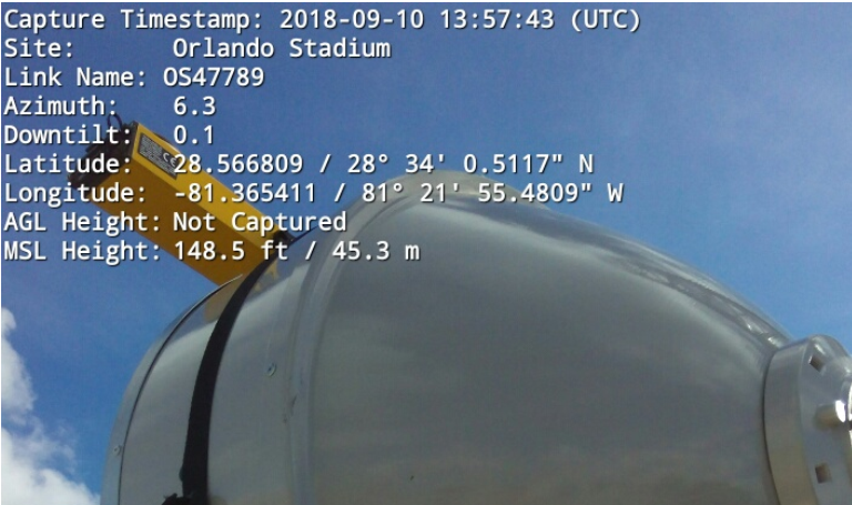
Generate and send PDF reports, CSV exports, line-of-sight imagery and Google Earth files directly from the field.
Durable by Design
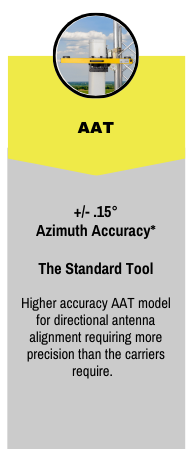
Rugged aluminum construction, sealed hardware, and no onboard display reduce potential issues due to rough handling. The AAT supports mounting via Picatinny/MLOK rails. The housing also includes and inserts to support custom mounting solutions for specialized installations.
Flexible Across Applications
Used across telecom, microwave, broadcast, defense, satellite, and custom infrastructure deployments worldwide.


Recent Posts
White Papers
- GPS/GNSS Compass Systems – Alignment in the Real World
- RF Antenna Misalignment Effects on 4G/LTE Data Throughput
- The Critical Nature of GNSS Azimuth Accuracy
- Improving E911 Location Accuracy for non-GNSS Circumstances
- Effect of Google Earth and Angle of Arrival Inaccuracies on E911 Location
- AGL Accuracy – GPS Height Estimates vs. Measured LASER Rangefinder AGL